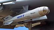
Iran publishes map of new Strait of Hormuz zone under its control


Iran’s Islamic Revolutionary Guard Corps (IRGC) Navy has released a map outlining what it describes as a newly defined area of the Strait of Hormuz under the management and control of the country’s armed forces.
According to Iran’s Fars News Agency, the map delineates boundaries that Tehran says fall within its operational oversight in the strategic waterway, through which a significant share of global oil shipments passes, News.Az reports.
The area is defined to the south by a line between Kuh-e Mobarak in Iran and southern Fujairah in the United Arab Emirates, and to the west by a line between the end of Iran’s Qeshm Island and Umm Al Quwain in the UAE.
RECOMMENDED STORIES
The announcement comes amid rising tensions over maritime security in the region. US Central Command (CENTCOM) and the US president said a day earlier that Washington would begin operations from Monday under what they called “Project Freedom” to ensure the movement of commercial vessels through the strait.
In response, the commander of Iran’s Khatam al-Anbiya Central Headquarters reiterated that Tehran maintains control over the waterway and that all transit must be coordinated with its forces.
“The security of the Strait of Hormuz is under our control, and any passage must be carried out in coordination with our armed forces,” he said.
He also warned that foreign military forces, particularly the United States, would face attack if they attempted to approach or enter the strait.
“We warn that any foreign military force, especially the invading US military, if it intends to approach or enter the Strait of Hormuz, will come under attack,” he said.

Similar news